Subjective Mapping: Reversing Cultural Representation
2017
Breda (NL)
Information Design, Mapping
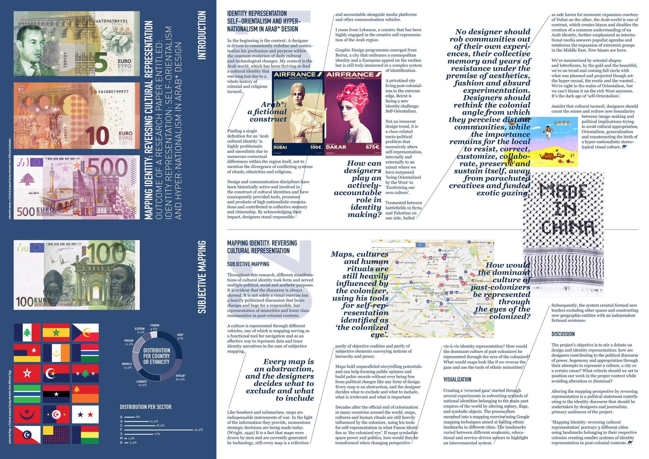
If maps symbolize space, power and politics, how would they be transformed when changing perspective vis-à-vis identity representation? How would the dominant culture of past-colonizers be represented through the eyes of the colonized?
In this project, I reverse the colonial gaze through several experiments, subverting symbols of national identities belonging to past empires of the world by altering money, flags, stamps as well as symbolic visuals and everyday objects. New maps are formed through the mapping of three EU cities and the landmarks of their ethnic minorities while consciously erasing all the remaining spaces. Altering the mapping perspective through the reversal of representation is a political statement contributing to the identity discourse that should be undertaken by designers, design theorists and journalists, primary audiences of the project.
Maps hold unparalleled storytelling potential and can help form collective opinion and build public morale without ever being free from political charge. Every map is an abstraction, and the designer decides what to exclude and what to include, what is irrelevant and what is important.
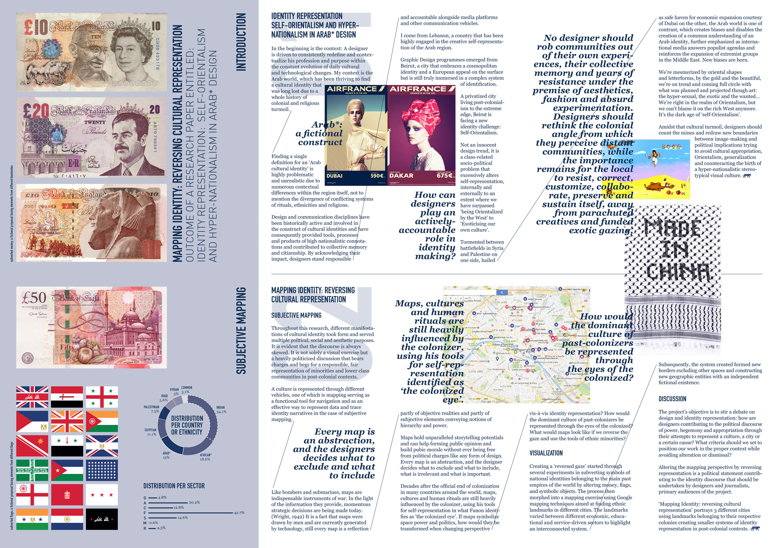
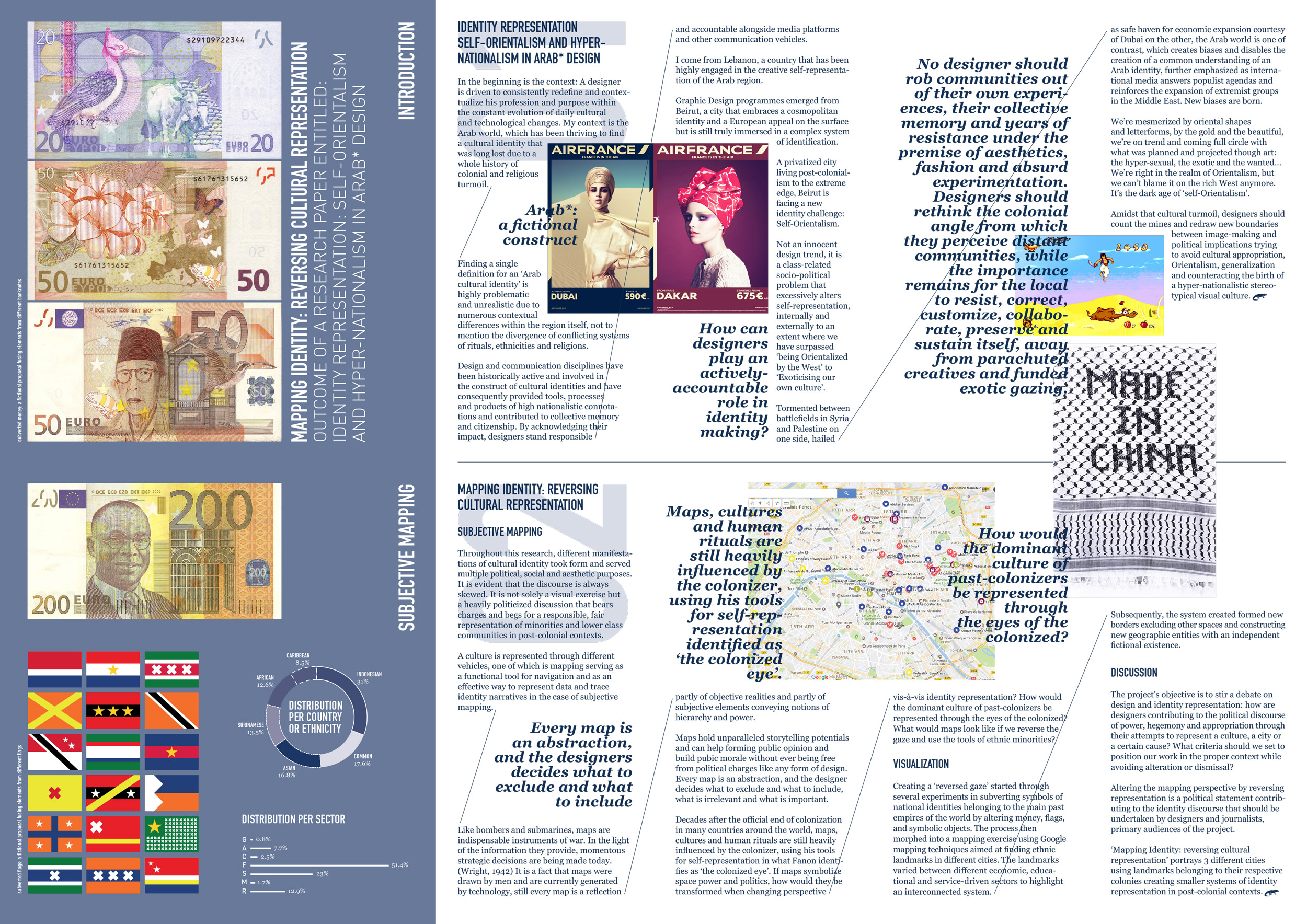
The series of subverted maps constitute the outcome of my MA thesis entitled ‘Identity Representation: Self-Orientalism and Hyper-Nationalism in Arab* Design, 2017’.
The thesis invites designers to rethink the colonial angle from which they perceive distant communities, while the importance remains on the local to resist, correct, customize, collaborate, preserve and sustain itself, away from parachuted creatives and funded exotic gazing.
Backed by a strong sense of self-awareness and fallibility, they can – and should – be open to self and reflective critique to elevate their work. By pushing the boundaries, they champion a universal discourse that necessitates more divergent thinking at times of political turmoil, ethnopluralism, hyper-nationalism and xenophobia.

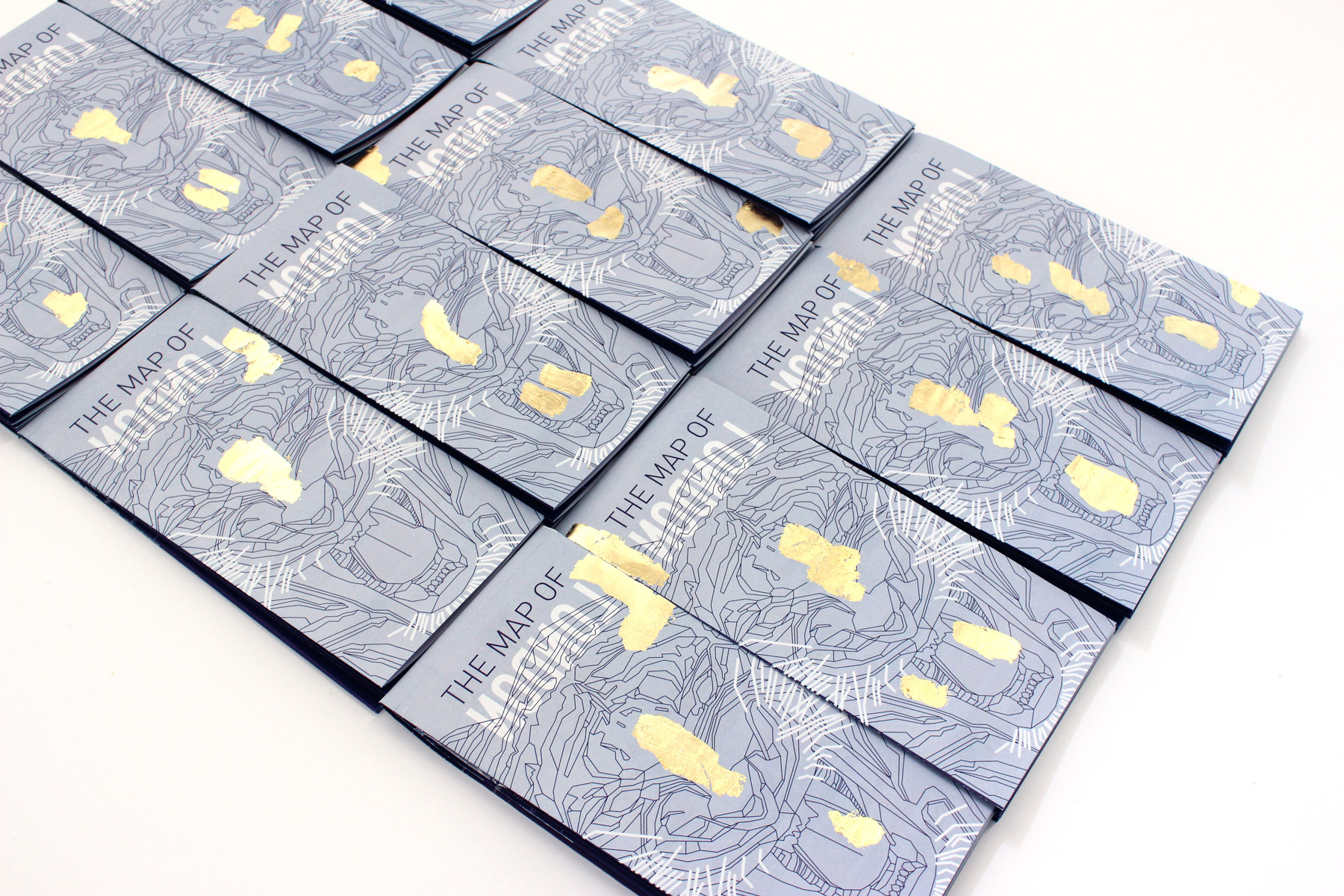
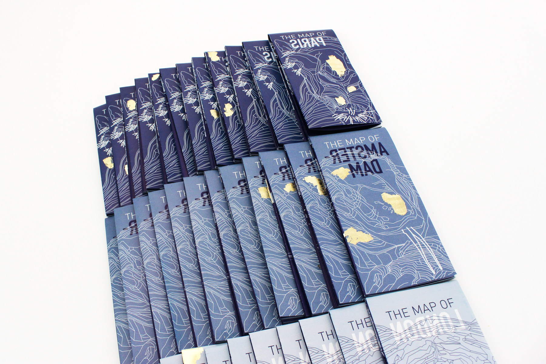
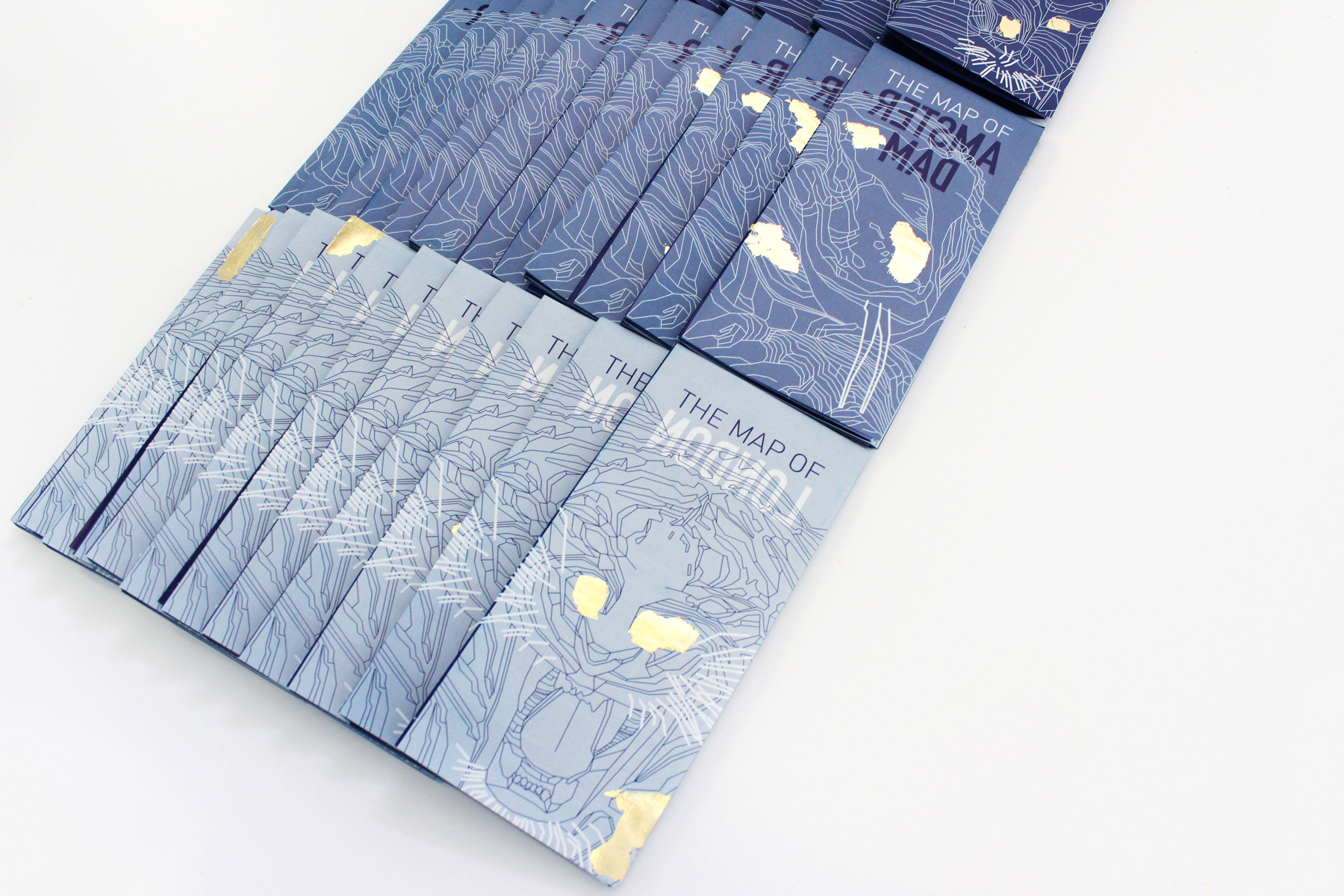
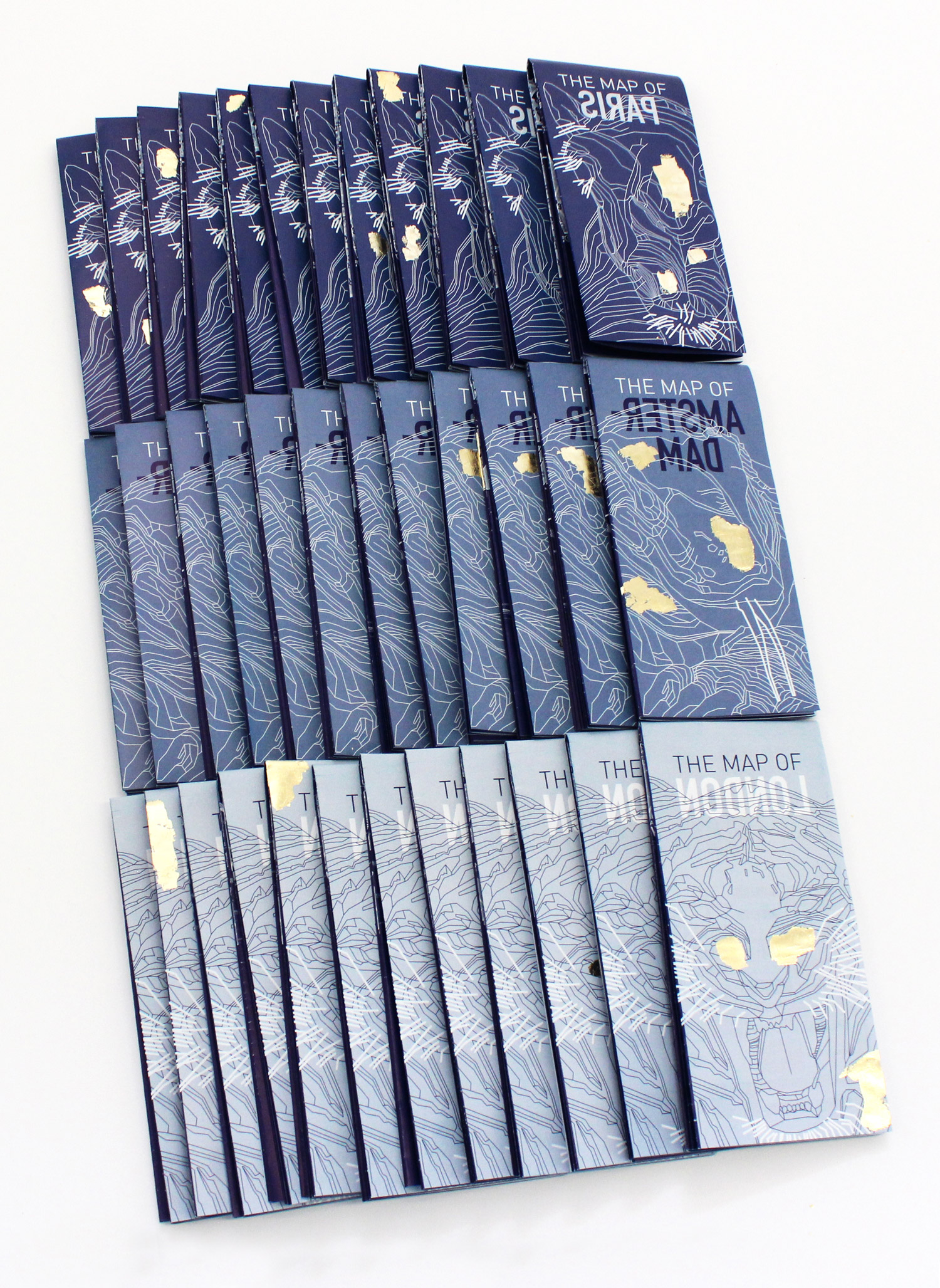
The mapping process: finding the landmarks belonging to ex-colonized minorities in London using Google Maps. The landmarks, categorized by sector and nationality, formed the new borders of the city. All other spaces were deleted and a new map was born.
The back side of the map provides the theoretical ground of the project as well as visualized data sets and reimagined flags.
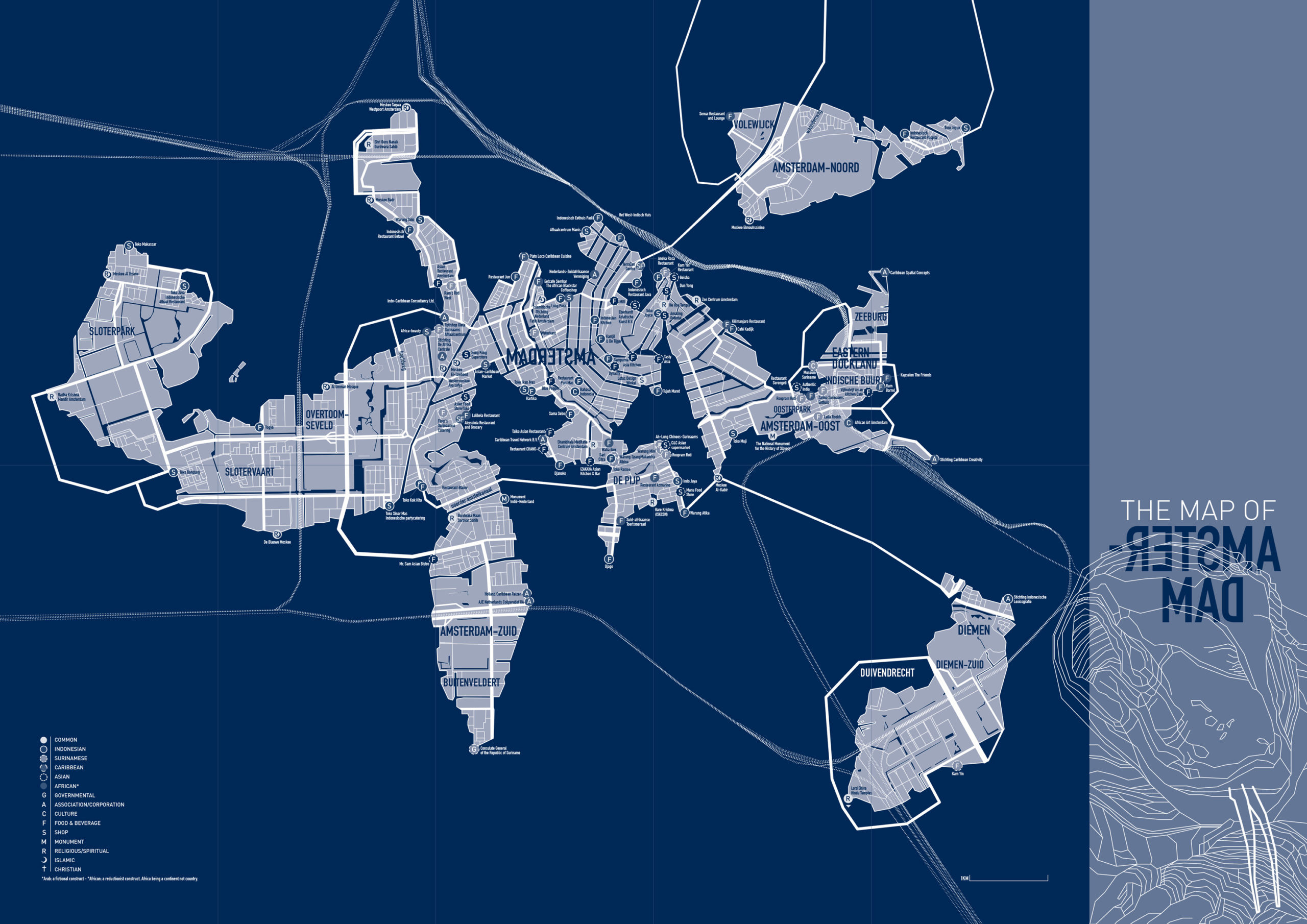
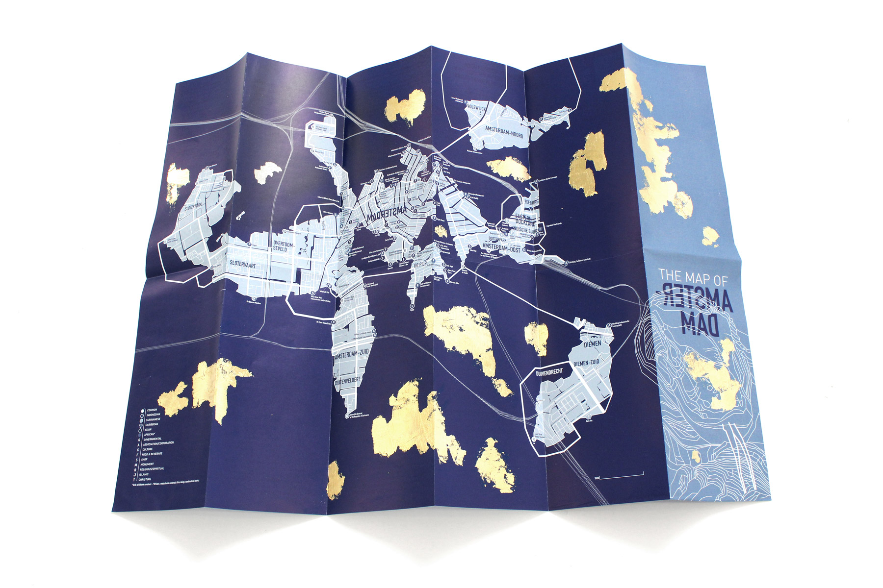
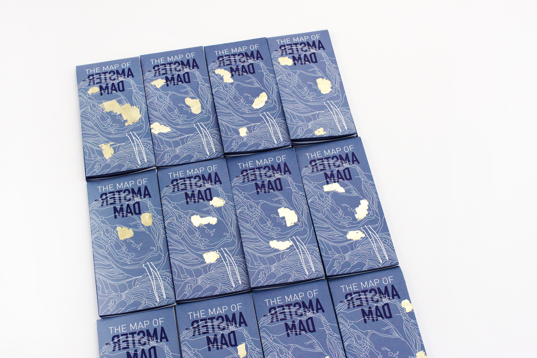
The mapping process: finding the landmarks belonging to ex-colonized minorities in Amsterdam using Google Maps. The landmarks, categorized by sector and nationality, formed the new borders of the city. All other spaces were deleted and a new map was born.
The back side of the map provides the theoretical ground of the project as well as visualized data sets and reimagined flags.
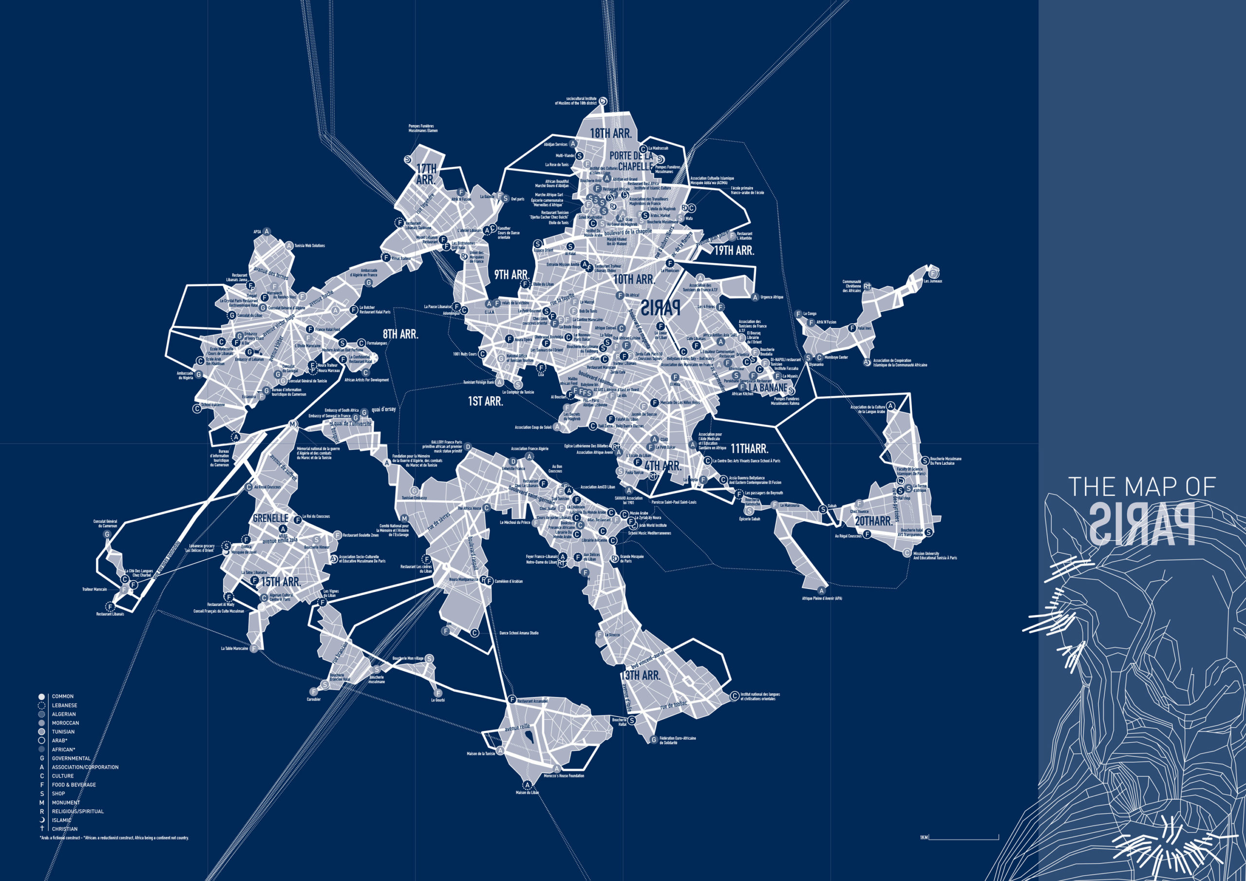
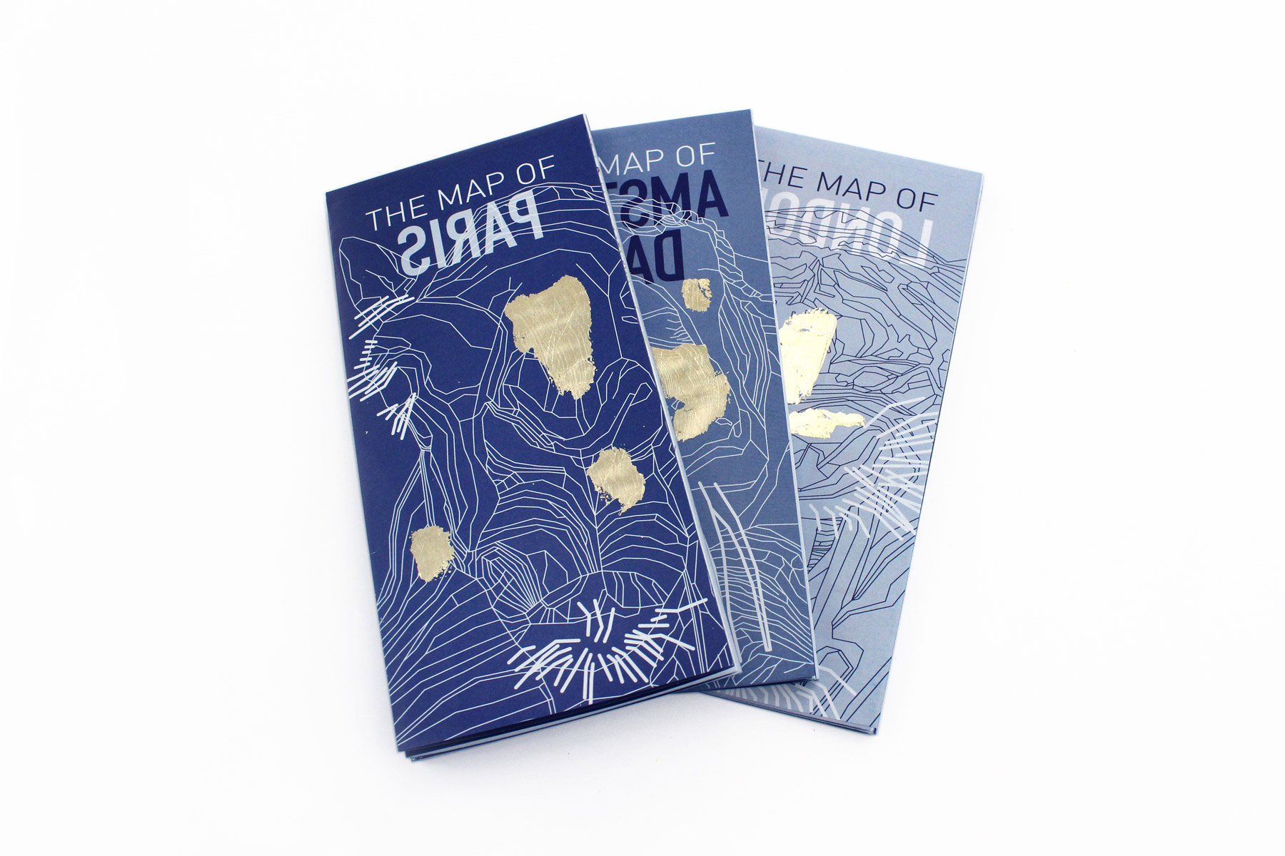
The mapping process: finding the landmarks belonging to ex-colonized minorities in Paris using Google Maps. The landmarks, categorized by sector and nationality, formed the new borders of the city. All other spaces were deleted and a new map was born.
The back side of the map provides the theoretical ground of the project as well as visualized data sets and reimagined flags.
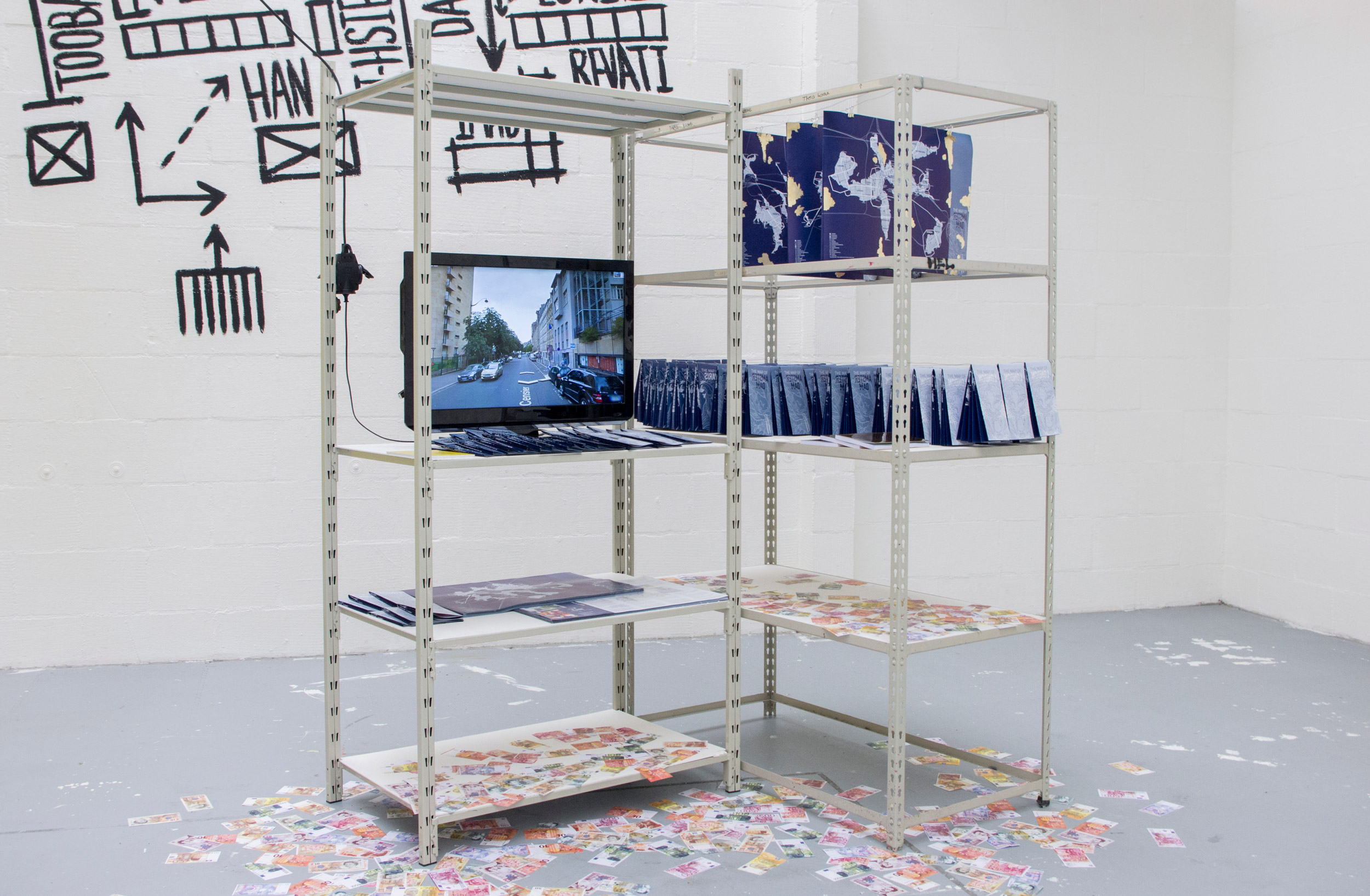
The project was exhibited during the 2017 Graduation Show at AKV St.Joost,'s-Hertogenbosch - NL
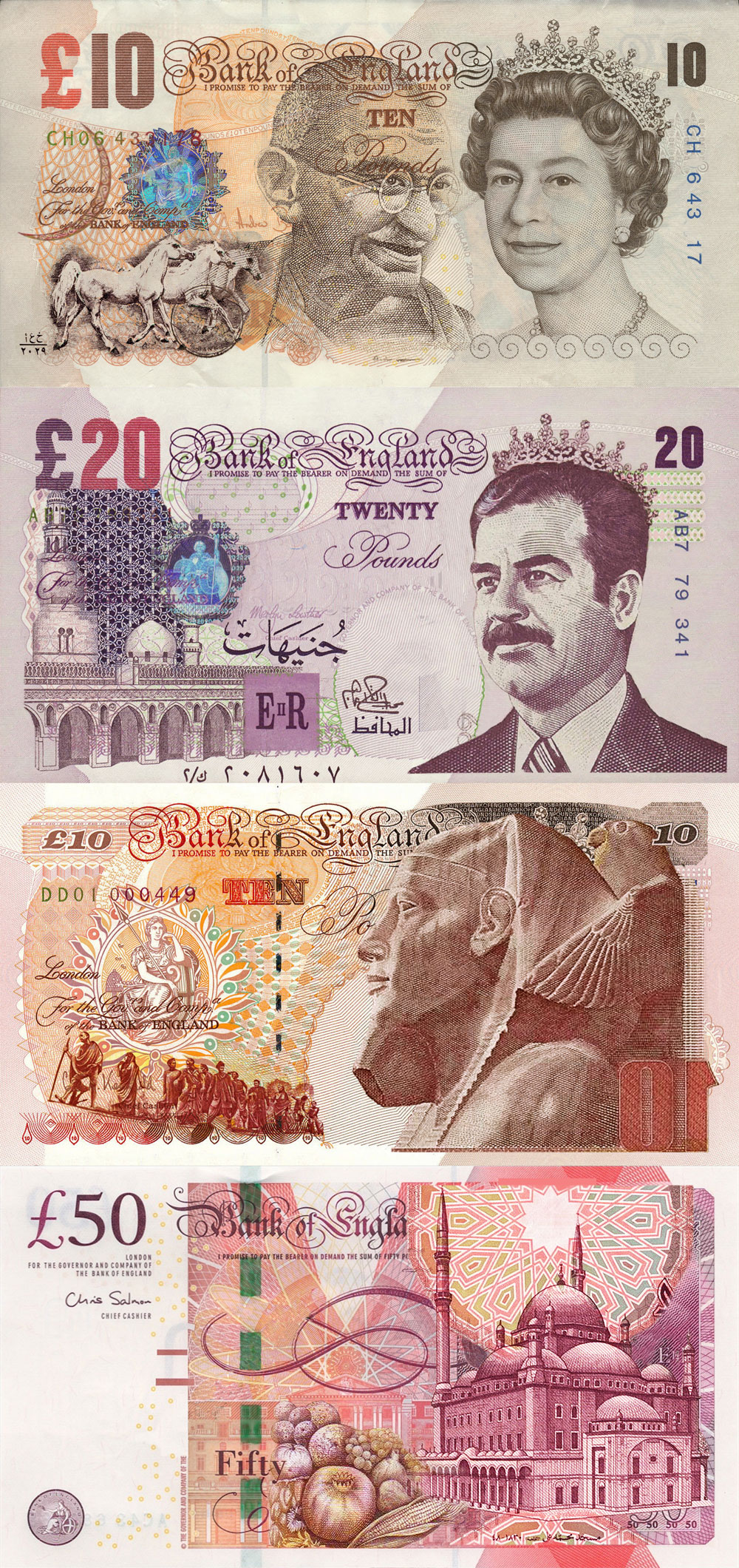
Speculative sets of currency combining Pound banknotes with currencies of the ex-colonies.
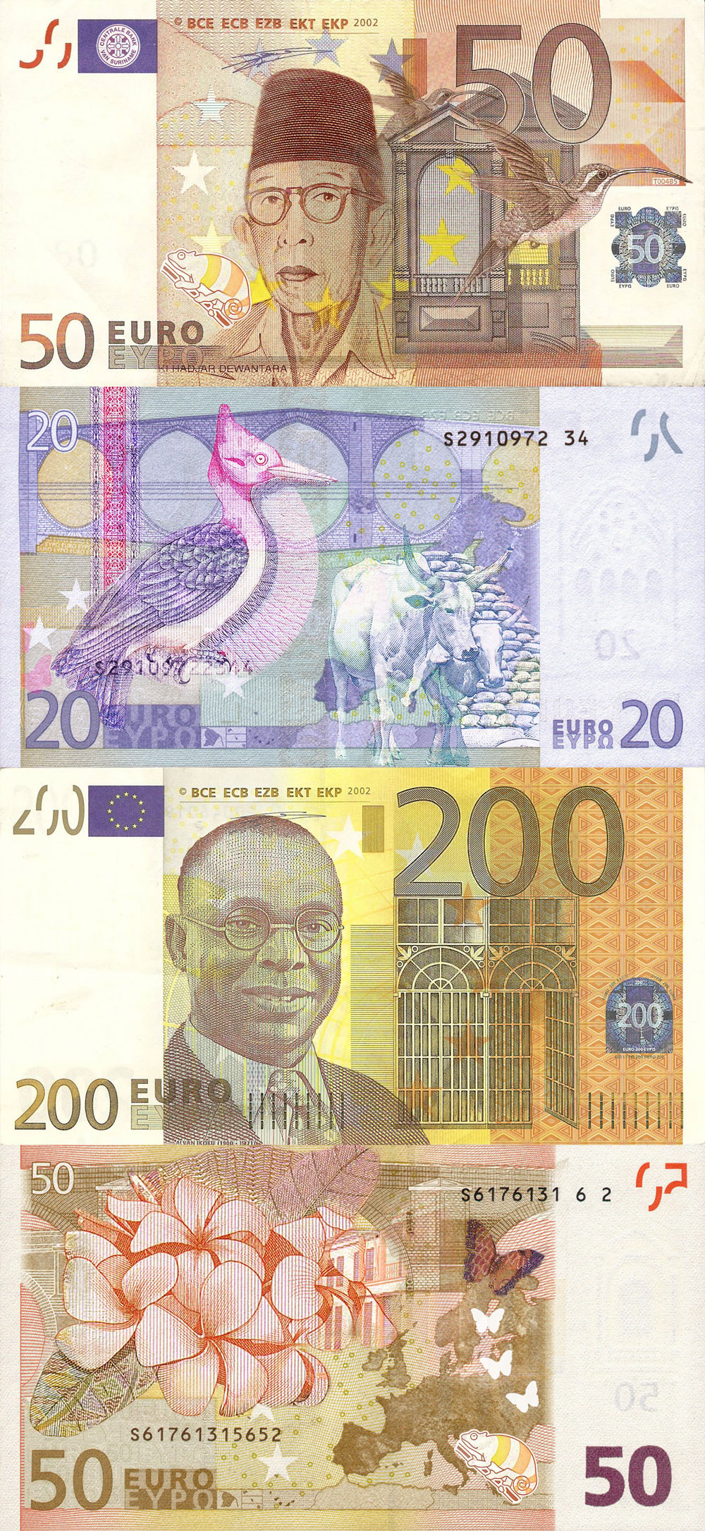
Speculative sets of currency combining Euro banknotes with currencies of the ex-colonies.
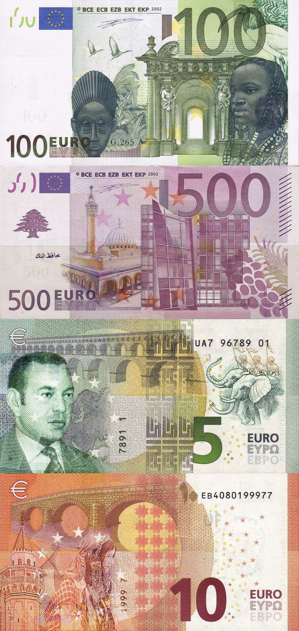
Speculative sets of currency combining Euro banknotes with currencies of the ex-colonies.
Altering the mapping perspective through the reversal of representation is a political statement contributing to the identity discourse that should be undertaken by designers, design theorists and journalists, primary audiences of the project. The series of subverted maps constitute the outcome of my MA thesis entitled ‘Identity Representation: Self-Orientalism and Hyper-Nationalism in Arab* Design, 2017’.


https://www.imadgebrayel.com/wp-content/uploads/2019/12/Subjective_Mapping_Imad-Gebrayel_London_A-scaled.jpg
https://www.imadgebrayel.com/wp-content/uploads/2019/12/Subjective_Mapping_Imad-Gebrayel_London_B.jpg
https://www.imadgebrayel.com/wp-content/uploads/2019/12/Subjective_Mapping_Imad-Gebrayel_Amsterdam_A-scaled.jpg
https://www.imadgebrayel.com/wp-content/uploads/2019/12/Subjective_Mapping_Imad-Gebrayel_Amsterdam_B.jpg
https://www.imadgebrayel.com/wp-content/uploads/2019/12/Subjective_Mapping_Imad-Gebrayel_Paris_A-scaled.jpg
https://www.imadgebrayel.com/wp-content/uploads/2019/12/Subjective_Mapping_Imad-Gebrayel_Paris_B.jpg
https://www.imadgebrayel.com/wp-content/uploads/2019/12/Subjective_Mapping_Imad-Gebrayel.jpg
https://www.imadgebrayel.com/wp-content/uploads/2019/12/Subjective_Mapping_Imad-Gebrayel_3.jpg
https://www.imadgebrayel.com/wp-content/uploads/2019/12/ImadGebrayel_cur_lon-1.jpg
https://www.imadgebrayel.com/wp-content/uploads/2019/12/ImadGebrayel_cur_ams.jpg
https://www.imadgebrayel.com/wp-content/uploads/2019/12/ImadGebrayel_cur_par-1.jpg
https://www.imadgebrayel.com/wp-content/uploads/2019/12/Subjective_Mapping_Imad-Gebrayel_4.jpg
https://www.imadgebrayel.com/wp-content/uploads/2019/12/Subjective_Mapping_Imad-Gebrayel_6.jpg
https://www.imadgebrayel.com/wp-content/uploads/2019/12/Subjective_Mapping_Imad-Gebrayel_8.jpg
https://www.imadgebrayel.com/wp-content/uploads/2019/12/Subjective_Mapping_Imad-Gebrayel_7.jpg
https://www.imadgebrayel.com/wp-content/uploads/2019/12/Subjective_Mapping_Imad-Gebrayel_5.jpg

Subjective Mapping: Reversing Cultural Representation
2017
Breda (NL)
Information Design, Mapping
3 EU cities are mapped according to the landmarks of their respective colonies, creating decolonial systems of identification.
If maps symbolize space, power and politics, how would they be transformed when changing perspective vis-à-vis identity representation? How would the dominant culture of past-colonizers be represented through the eyes of the colonized?
In this project, I reverse the colonial gaze through several experiments, subverting symbols of national identities belonging to past empires of the world by altering money, flags, stamps as well as symbolic visuals and everyday objects. New maps are formed through the mapping of three EU cities and the landmarks of their ethnic minorities while consciously erasing all the remaining spaces. Altering the mapping perspective through the reversal of representation is a political statement contributing to the identity discourse that should be undertaken by designers, design theorists and journalists, primary audiences of the project.
Maps hold unparalleled storytelling potential and can help form collective opinion and build public morale without ever being free from political charge. Every map is an abstraction, and the designer decides what to exclude and what to include, what is irrelevant and what is important.
The series of subverted maps constitute the outcome of my MA thesis entitled ‘Identity Representation: Self-Orientalism and Hyper-Nationalism in Arab* Design, 2017’.
The thesis invites designers to rethink the colonial angle from which they perceive distant communities, while the importance remains on the local to resist, correct, customize, collaborate, preserve and sustain itself, away from parachuted creatives and funded exotic gazing.
Backed by a strong sense of self-awareness and fallibility, they can – and should – be open to self and reflective critique to elevate their work. By pushing the boundaries, they champion a universal discourse that necessitates more divergent thinking at times of political turmoil, ethnopluralism, hyper-nationalism and xenophobia.

The mapping process: finding the landmarks belonging to ex-colonized minorities in London using Google Maps. The landmarks, categorized by sector and nationality, formed the new borders of the city. All other spaces were deleted and a new map was born.
The back side of the map provides the theoretical ground of the project as well as visualized data sets and reimagined flags.
The mapping process: finding the landmarks belonging to ex-colonized minorities in Amsterdam using Google Maps. The landmarks, categorized by sector and nationality, formed the new borders of the city. All other spaces were deleted and a new map was born.
The back side of the map provides the theoretical ground of the project as well as visualized data sets and reimagined flags.
The mapping process: finding the landmarks belonging to ex-colonized minorities in Paris using Google Maps. The landmarks, categorized by sector and nationality, formed the new borders of the city. All other spaces were deleted and a new map was born.
The back side of the map provides the theoretical ground of the project as well as visualized data sets and reimagined flags.
The project was exhibited during the 2017 Graduation Show at AKV St.Joost,'s-Hertogenbosch - NL
Speculative sets of currency combining Pound banknotes with currencies of the ex-colonies.
Speculative sets of currency combining Euro banknotes with currencies of the ex-colonies.
Speculative sets of currency combining Euro banknotes with currencies of the ex-colonies.